
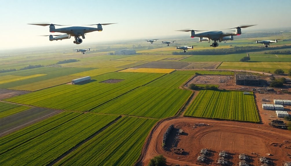
Drones are broadening possibilities across multiple industries by enhancing efficiency and data collection. In agriculture, they facilitate precision farming through real-time monitoring and soil analysis. Construction projects benefit from rapid aerial surveys, improving safety and decision-making. Emergency services use drones for quick assessments and medical supply delivery. Furthermore, drones change scientific research by providing access to challenging terrains. Aerial photography redefines media and marketing strategies. Their impact is extensive, showcasing innovative applications yet to be fully explored.
Revolutionizing Agriculture With Precision Farming
As agricultural demands grow alongside global population increases, drones have emerged as crucial tools in precision farming. Leveraging advanced drone technology, farmers can conduct thorough crop monitoring and soil analysis, enhancing yield optimization strategies. By utilizing data analytics, they can identify nutrient deficiencies and implement targeted interventions, ensuring resources are used efficiently. Drones facilitate effective pest management through real-time surveillance, allowing for timely treatments that minimize crop loss.
Aerial irrigation systems enable precise water distribution, greatly improving resource management. Furthermore, drones streamline farm mapping and weather assessment, providing essential information for informed decision-making. Livestock tracking is transformed through aerial capabilities, allowing farmers to monitor health and movement with unprecedented accuracy. By integrating these innovative techniques, agriculture is changed, empowering stakeholders to achieve maximum productivity and sustainability in an increasingly competitive environment. The future of farming is undeniably intertwined with drone-enabled precision.
Enhancing Construction Projects Through Aerial Surveys
Drones are increasingly reshaping various sectors, including construction, by offering innovative aerial survey solutions. These unmanned aerial vehicles (UAVs) facilitate precise site mapping and thorough aerial inspections, greatly improving project efficiency and accuracy.
Key advantages of drone technology in construction include:
- Rapid Data Collection: Drones can quickly gather extensive site data, reducing the time needed for traditional surveying methods.
- Cost Efficiency: By minimizing labor and equipment costs associated with manual inspections, drones provide a more economical solution.
- Improved Safety: Aerial inspections reduce the need for personnel to access hazardous areas, safeguarding workers.
As the construction industry embraces these advancements, decision-makers are empowered with real-time insights and high-resolution imagery, enabling them to make informed choices that drive successful project outcomes. The integration of drone technology is not merely an improvement; it is a transformative force redefining construction methodologies.
Transforming Emergency Services and Disaster Response
Drones are revolutionizing emergency services by facilitating rapid medical supply delivery in critical situations. Their ability to provide real-time situation assessments improves response strategies during disasters. This technological advancement is proving crucial in saving lives and increasing overall efficiency in emergency management.
Rapid Medical Supply Delivery
In critical situations, the swift delivery of medical supplies can be the difference between life and death. Drone technology is revolutionizing medical logistics, enabling rapid response in emergencies and disaster scenarios. By utilizing the strength of unmanned aerial vehicles, healthcare providers can guarantee timely interventions, directly impacting patient outcomes.
Key benefits of drone-assisted medical supply delivery include:
- Speed: Drones can traverse challenging terrains quickly, bypassing traffic and obstacles.
- Accessibility: Remote and underserved areas receive crucial medical supplies, bridging critical gaps in healthcare.
- Cost-effectiveness: Reduced transportation costs improve resource allocation for medical services.
Through these advancements, drone technology is transforming emergency services while redefining the environment of disaster response, empowering organizations to act decisively when it matters most.
Real-Time Situation Assessment
Utilizing advanced drone technology for real-time situation assessment has become a transformative factor in emergency services and disaster response. Drones equipped with high-resolution cameras and sensors improve situation awareness, enabling responders to gather critical data swiftly and accurately. This innovation empowers crisis management teams to make informed decisions, minimizing response times and optimizing resource deployment. By providing aerial views of disaster zones, drones allow for the identification of hazards, assessment of damage, and monitoring of evolving situations. As a result, emergency services can coordinate efforts more effectively, ensuring that aid reaches those in need without delay. Consequently, the integration of drones into emergency operations not only improves efficiency but also saves lives during critical moments.
Improving Infrastructure Inspection and Maintenance
Revolutionizing infrastructure inspection and maintenance, advanced drone technology offers a game-changing solution for monitoring and evaluating critical assets. This innovative approach improves infrastructure resilience by enabling swift identification of potential issues before they escalate into costly problems. Drones provide unparalleled access to hard-to-reach areas, ensuring thorough inspections without compromising safety.
Key advantages of utilizing drone technology in infrastructure inspection include:
- Improved Data Collection: Drones capture high-resolution imagery and real-time data, enabling precise assessments.
- Cost Efficiency: Reduced need for scaffolding or manual inspections minimizes operational costs considerably.
- Rapid Response: Immediate data analysis allows for quick decision-making and timely maintenance actions.
As industries increasingly adopt this state-of-the-art technology, the future of infrastructure management is poised for unprecedented efficiency and reliability, ensuring robust systems that stand the test of time.
Enabling Efficient Delivery and Logistics Solutions
Drones are transforming delivery and logistics operations by streamlining processes and enhancing efficiency. In an era where speed and precision are paramount, drone logistics emerge as a pivotal solution for last mile delivery. These unmanned aerial vehicles not just minimize transit times but also greatly reduce labor costs and human error. By utilizing advanced navigation systems and real-time data analytics, businesses can guarantee timely and accurate deliveries, thereby elevating customer satisfaction. The capability to bypass traditional transportation obstacles further empowers organizations to reach remote or congested areas with ease. As industries increasingly adopt drones for logistics, they open up new revenue streams and reinforce their competitive edge. This technology not only transforms the supply chain but additionally sets a new standard for operational excellence, positioning companies at the forefront of innovation. In this environment, those who utilize drone logistics will certainly command an advantage in the marketplace.
Advancing Environmental Monitoring and Conservation
As industries utilize the capabilities of unmanned aerial vehicles for logistics, their application extends into the domain of environmental monitoring and conservation. Drone technology empowers organizations to conduct precise assessments and analyses vital for sustaining ecosystems. This innovative approach amplifies conservation efforts by enabling:
- Wildlife Tracking: Monitoring animal movements and behaviors to guarantee species preservation.
- Pollution Monitoring: Detecting contaminants in air and water, facilitating prompt interventions.
- Habitat Assessment: Evaluating the health of various ecosystems to inform restoration projects.
Through advanced ecosystem analysis, drones provide invaluable data visualization that improves comprehension of climate change impacts. This data-driven approach equips environmentalists with the insights needed to adapt strategies effectively. By utilizing drone technology, industries not merely advance their operational capabilities but additionally take significant strides in safeguarding the environment, assuring a harmonious balance between progress and preservation.
Supporting Mining Operations and Resource Management
Drones are transforming mining operations by introducing improved surveying techniques that improve accuracy and efficiency. With the ability to collect real-time data, these aerial devices facilitate better resource management and decision-making. As a result, the mining industry can optimize its processes during minimizing environmental impacts.
Enhanced Surveying Techniques
A growing number of industries are leveraging improved surveying techniques to support mining operations and resource management. Drones facilitate augmented aerial mapping, providing unparalleled access to detailed topography. This technology transforms traditional surveying methods, allowing for more efficient resource evaluation and extraction strategies.
Key advantages include:
- Precision: Drones capture high-resolution imagery and data, ensuring accurate assessments of terrain and resources.
- Efficiency: Aerial mapping reduces labor costs and time, expediting project timelines.
- Safety: Utilizing drones minimizes the need for personnel in hazardous environments, protecting workers as well as maintaining productivity.
As these advanced surveying techniques proliferate, they empower industries to maximize resource potential and optimize operational effectiveness. The future of mining relies heavily on these innovations.
Real-Time Data Collection
Increasingly, real-time data collection is revolutionizing the way mining operations and resource management are conducted. The integration of drone sensors facilitates the acquisition of critical data with unparalleled speed and accuracy, empowering decision-makers to capitalize on opportunities and mitigate risks effectively. With real-time analytics, organizations can monitor environmental conditions, assess resource availability, and optimize operational efficiency on-the-fly. This immediacy transforms traditional workflows, allowing for agile responses to dynamic challenges within the mining sector. Furthermore, the ability to gather extensive geospatial data improves strategic planning and resource allocation, ensuring sustainable practices as well as maximizing profitability. In a competitive environment, leveraging advanced drone technology for real-time insights becomes an indispensable asset for industry leaders seeking to maintain their edge.
Elevating Film and Photography With Aerial Perspectives
How can filmmakers and photographers capture the world from breathtaking angles that were once deemed impossible? Drones have emerged as a transformative tool in the domains of film and photography, enabling artists to embrace aerial storytelling with unprecedented ease. This cinematic innovation empowers creators to explore perspectives that raise their work, enchanting audiences like never before.
- Dynamic aerial shots that improve narrative depth
- Seamless tracking of subjects in motion
- Unique vantage points that redefine visual storytelling
Innovating Real Estate Marketing and Property Management
Drones are transforming real estate marketing and property management by offering unique advantages in aerial photography. These tools improve virtual tours, providing potential buyers with immersive experiences that traditional methods cannot match. Furthermore, drones boost property inspections by quickly and efficiently evaluating hard-to-reach areas, streamlining the management process.
Aerial Photography Advantages
As real estate professionals seek innovative ways to showcase properties, aerial photography has emerged as a potent tool that improves marketing strategies and property management. By leveraging aerial perspectives, agents can captivate potential buyers with stunning visuals that tell a compelling story about the property and its surroundings. This creative storytelling approach not merely enhances listings but also boosts brand identity.
Key advantages of aerial photography include:
- Improved Visual Appeal: Stunning images that highlight property features from unique angles.
- Comprehensive Property Insight: Showcases the property's layout and its relationship to the surrounding environment.
- Competitive Edge: Distinguishes listings in a crowded market, attracting more attention and inquiries.
Incorporating aerial photography empowers real estate professionals to command attention and drive results.
Virtual Tours Enhancement
Even though traditional property viewings remain important, virtual tours have transformed real estate marketing and property management by offering an immersive experience that transcends geographical limitations. Utilizing advanced virtual reality technology, these tours provide potential buyers and renters with interactive experiences that engage their senses and emotions. This innovative approach not just boosts property visibility but also empowers clients to explore spaces at their convenience, eliminating the need for time-consuming physical visits. As a result, real estate professionals can showcase properties more effectively, reaching a broader audience and increasing the likelihood of successful transactions. By integrating drone technology with virtual tours, the industry is redefining how properties are marketed, in the end positioning itself as a leader in modern real estate practices.
Property Inspections Efficiency
An increasing number of real estate professionals are leveraging drone technology to improve property inspection efficiency. This innovative approach transforms property evaluation by providing high-resolution aerial imagery and extensive data analysis. Drones enable a thorough inspection process, reducing time and resources as well as enhancing accuracy.
Key benefits of using drone technology in property inspections include:
- Extensive Visuals: Drones capture detailed images of roofs, facades, and surrounding environments, revealing potential issues previously unnoticed.
- Rapid Assessment: The speed of drone inspections accelerates the evaluation process, allowing for timely decision-making.
- Cost-Effectiveness: By minimizing the labor required for traditional inspections, drone technology reduces overall costs for real estate transactions.
Incorporating drones in property inspections raises the standards of real estate marketing and management.
Streamlining Telecommunications and Network Management
With the rapid advancement of drone technology, telecommunications and network management are undergoing significant transformations. Drones are proving to be invaluable assets in the deployment and maintenance of communication networks, enhancing operational efficiencies and reducing costs. By utilizing drone communication technologies, companies can conduct real-time inspections of infrastructure, swiftly identify faults, and implement network enhancement strategies with unparalleled precision.
These aerial systems facilitate the rapid assessment of remote sites, enabling telecommunications providers to extend their reach into underserved areas. The agility of drones allows for the swift adjustment of network configurations, ensuring ideal performance in dynamic environments. Moreover, the data collected through drone surveillance empowers decision-makers to strategize effectively, nurturing a setting where connectivity is both robust and reliable. As this technology continues to evolve, its influence on telecommunications will only intensify, establishing a new paradigm of efficiency and strength in network management.
Expanding Scientific Research and Data Collection Efforts
The capabilities of drone technology extend beyond telecommunications, greatly enhancing scientific research and data collection efforts. By leveraging drones in ecology, researchers can access previously unreachable areas, gathering critical data with unprecedented efficiency. This technological advancement enables scientists to conduct thorough aerial data analysis, transforming the terrain of environmental studies.
Key benefits of utilizing drones in scientific research include:
- Precision Mapping: Drones provide high-resolution imagery for accurate terrain and habitat mapping.
- Real-Time Monitoring: They enable continuous data collection, facilitating immediate responses to environmental changes.
- Cost Efficiency: Drones reduce the need for extensive manpower and resources traditionally required for data collection.
As the integration of drones becomes more prevalent in scientific fields, the potential for groundbreaking discoveries expands, reshaping methodologies and enhancing the quality of data collected. The strength of aerial technology is poised to redefine the future of research and ecological conservation.
Frequently Asked Questions
What Regulations Govern Drone Usage Across Different Industries?
Regulations governing drone usage vary markedly across industries, emphasizing the importance of drone licensing and industry compliance. Authorities establish stringent guidelines to guarantee safety, privacy, and operational integrity. Organizations must adhere to local and national laws, which often require pilots to obtain specific certifications and operational permissions. Non-compliance can result in severe penalties, underscoring the necessity for companies to stay informed and proactive in managing their drone operations within the regulatory environment.
How Do Drones Impact Job Opportunities in Various Sectors?
The theory that drones will markedly reshape job environments is increasingly supported by emerging evidence. As industries adopt drone technology, a demand for specialized drone training arises, leading to job creation in sectors like agriculture, logistics, and surveillance. This evolving ecosystem not solely cultivates new career opportunities but additionally necessitates upskilling for existing workers, ensuring a dynamic workforce adept at maneuvering the intricacies of a drone-enhanced economy. The future appears promising for those ready to embrace this shift.
What Are the Safety Concerns Associated With Drone Operations?
The safety concerns associated with drone operations are significant and multifaceted. Primarily, drone collisions pose a serious risk, particularly in crowded airspaces where manned aircraft operate. Furthermore, the potential for privacy violations raises alarms among the public, as drones can inadvertently or intentionally capture sensitive information. These issues necessitate stringent regulations and strong technological solutions to guarantee safe and ethical drone usage, safeguarding both airspace integrity and individual privacy rights.
How Much Does It Cost to Implement Drone Technology?
What is the true cost of embracing state-of-the-art technology? Implementing drone technology involves a thorough cost analysis, with budget considerations that can vary widely based on operational needs and scale. Initial investments include hardware, software, training, and maintenance. Furthermore, regulatory compliance can impose further financial burdens. In the end, organizations must weigh these costs against the potential benefits to determine if the investment aligns with their strategic objectives and vision for growth.
What Are the Environmental Impacts of Widespread Drone Usage?
The environmental impacts of widespread drone usage warrant careful examination. Drone emissions contribute to air pollution, raising concerns about their long-term effects on climate change. Furthermore, the presence of drones in natural habitats can lead to wildlife disruption, as animals may become stressed or alter their behaviors in response to aerial disturbances. As industries adopt drone technology, stakeholders must consider these ecological consequences to guarantee sustainable practices that balance innovation with environmental stewardship.